Is it legal to ride round a nuclear power station? Where can you find the best ice-cream in the north-east of England? Will the perfect weather forecast be correct? Olly heads north in search of gravelly answers.
“I don’t think it counts as bikepacking unless you sleep in a ditch, drink from a puddle and wake up with a slug on your face” said our friend Matt. My wife and I were telling him about our plans to head up the coast for a couple of days of gravelly bikepacking when he threw this spanner into the works. I had spent ages researching the perfect route, finding suitable accommodation, planning food stops and making offerings to the weather gods, but I hadn’t even considered the fact that what we had planned wasn’t actually what we thought it was.
Matt made a valid point, of course. Proper bikepacking does generally mean carrying some form of shelter, making your own food and being as least partly self-sufficient. But as the old trope goes, any fool can be cold and miserable. S eeing as neither of those were on our “must do” list, we decided to do a slightly less hardcore version of bikepacking instead. It was going to be a 200kms A-to-B ride, staying overnight in a lovely Bed&Breakfast and eating at local cafes (and more importantly ice-cream shops) along the route. We would have bikepacking luggage with us, but it only carried our overnight kit and a change of riding gear for the second day, rather than world-tour levels of gear carrying. Not perhaps entirely in the spirit of bikepacking, but hopefully we’d get all the good bits and less of the slugs….
Our route took us first, courtesy of LNER (whose on-line bike booking service was surprisingly efficient and simple) from our home city of Newcastle-upon-Tyne, 90 minutes north to the small Scottish coastal town of Dunbar. Many gravel cyclists start/finish multi-day bikepacking trips in Dunbar due its location at the southern terminus of the long distance John Muir trail, but the majority head north or west from there, whereas we were heading south, back towards home. Due to some geographic anomaly, the prevailing wind in the UK comes from the south-west and so the majority of advice given about bikepacking or cycle touring in the area is to ride northwards to ensure you have as high a chance as possible of a tailwind. We needed to finish back home, which meant heading south, but my offerings to the weather gods had obviously paid off as the forecast promised warm sunshine, blue skies and tail winds for the two days of our trip. Perfect.
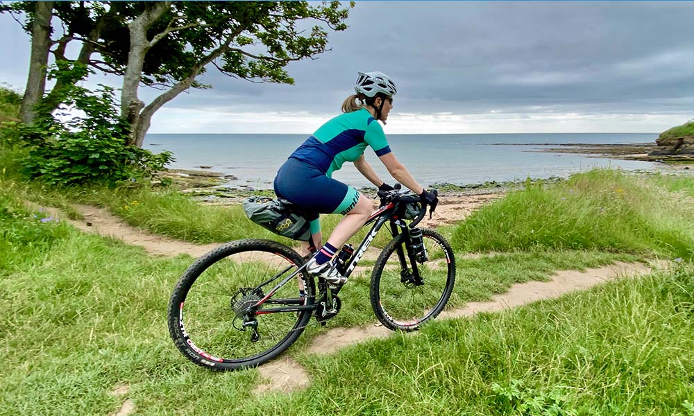
For any non-UK residents reading this, our archaic trail access rules will probably boggle your brains. In Scotland, egalitarian access rules mean essentially any trail you can see is legally rideable (with a few exceptions for military land, places where forestry activities are happening etc), whereas once you cross the border into England, the rules change and cyclists are then limited to a tiny fraction of the Public Rights of Way network. So, while we were in Scotland. we wanted to make the most of this freedom and set off down the John Muir link trail. This trail hugs the coastline and encompasses every surface possible from broken asphalt to grass to sand to loose pebbles. It was 99% rideable and was the perfect start to our trip – quiet, scenic and fun.
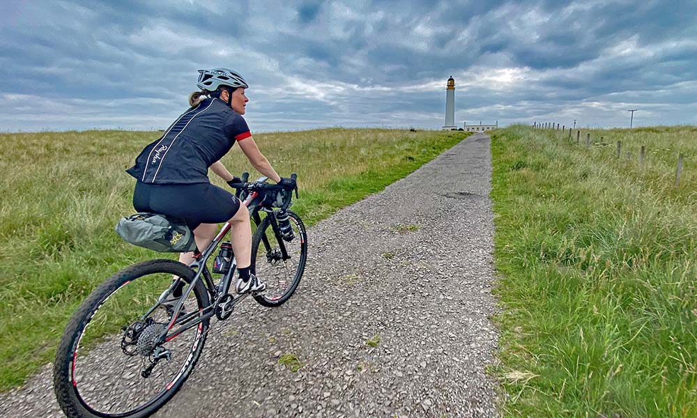
With my well documented love of seeking out new trails to ride my gravel bike on, a requirement to plan a two day gravel bikepacking trip that would be just the right mix of challenging and fun was something I was unsurprisingly happy to do. It did however, mean a lot of hours were whiled away pouring over aerial photographs, scouring bizarre internet forums and consulting a range of digital mapping options. My biggest concern was that there was quite a large lump of concrete, known as the Torness nuclear power station, located smack on our route, just a short distance south of our start point. The satellite imagery of the area was somewhat fuzzy (no surprise there) but the mapping showed a legally accessible trail running around the perimeter of the facility, located between it and the sea. I was somewhat dubious that this trail would actually exist and that we would be able to ride it, but my doubts were unfounded. When we got there, we found a perfect trail exactly where it was shown on the map, neatly signposted and surprisingly fun to ride.
I’d deliberately planned the route to make it a mix of gravel and minor roads. The first day was around 120kms – not that vast by pro standards, but we were on holiday after all. For the first 30kms or so south of Dunbar, the John Muir Link Trail runs right along the coast, in places actually along the beach itself.
While that sounded lovely in theory, I was a little worried that we would burn through quite a bit of time noodling along little strips of semi-rideable singletrack, so in places I took the safe option and routed us inland. It cut down on the proportion of gravel, but meant we didn’t have to worry about a late arrival at our overnight accommodation.
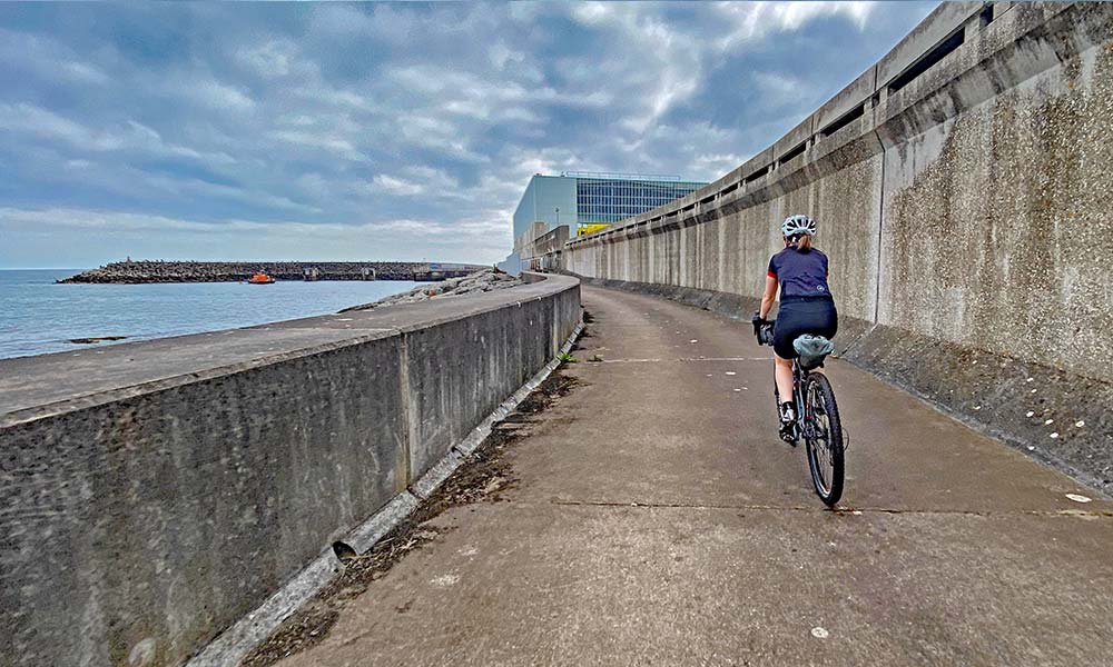
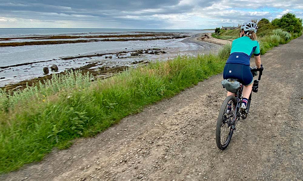
We got through Scotland disappointingly quickly, but the further south we headed the better the weather got, so that made up somewhat for the changing access rules. By lunchtime we were back into England and headed into Berwick-upon-Tweed in search of some food. For anyone looking for really good coffee, vegetarian-friendly food and great cake, I can highly recommend this place. The fact the café had outside tables in the sunshine, where we could keep an eye on our bikes was even better. Lunch finished, we headed on south and soon picked up the Sandstone Way – a waymarked 200km off-road route which heads south-west across Northumberland. We only used the first section of it, but I knew from prior experience this was the best section for gravel bikes. A fantastic, hardpacked trail floated and swooped along the clifftops with the sea just off to our left. The tail wind had picked up slightly, so it felt like we flew along.
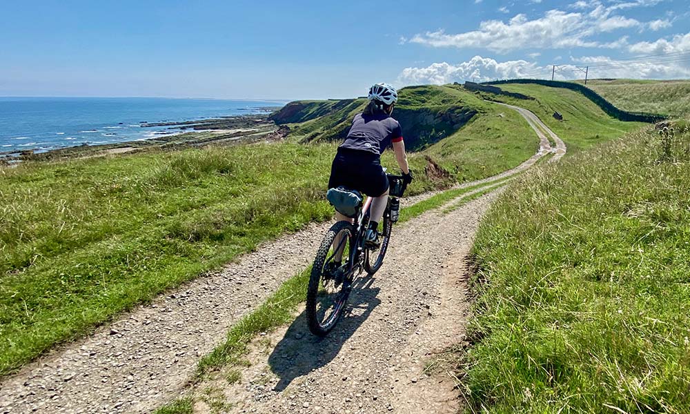
Our afternoon route was probably 60/40 road/off-road, which might not be enough for hardcore gravel riding fans, but the roads were so quiet and scenic that it didn’t matter. However, as we neared the tourist honey-pot site of Bamburgh it was actually quite a shock to be back on roads with traffic again. We’d gone from silence, punctuated only by occasional cries from buzzards circling overhead, to suddenly sharing our route with huge 4x4s. Luckily, I had a cunning plan up my sleeve, which was to hug the coast again and pick up a fantastic sandy bridleway which ran right around the headland north of Bamburgh. So indistinct in places that we could barely find it, the change from a few kms of riding on busy roads back to trail riding next to an azure blue sea was a very welcome one.
I’m going to be honest here and say that I’d really only included Bamburgh in the route because it has an award-winning ice-cream shop there. The fact that the coastal riding just before you get into the village was so good was a handy coincidence too of course. The temperature by this point was nudging 30 degrees, which for the north-east of England is pretty unusual, so an ice-cream on the village green was a great way to spend a bit of time. Core temperatures lowered slightly, we headed off on the last section to our overnight accommodation. We’ll quickly gloss over the bit of the trail that had been engulfed by chest high vegetation and the concrete World War II airbase access track which did a good job of rattling our fillings out and just remember the warm welcome on arrival at our accommodation. We’d traded up from a night in a ditch to a very smart room overlooking the gardens and an en-suite bathroom with a view of the sea. A well-stocked honesty bar, some fantastic homecooked food and a super comfy bed suggested our upgrade from slug&puddle class had been a wise one.
Day 2 dawned slightly overcast, but with a forecast promising warm temperatures, a tailwind and mid-morning sunshine. Within a few minutes of leaving our accommodation we were riding ‘primo’ gravel trails. Lots of it ran next to the sea and the hardpacked sand and gravel surface was fast-running and fun – an ideal wake up call for the day ahead.
From this point southwards we were on a mix of trails we knew pretty well and sections that had been plotted after some detailed research. We were heading pretty much due south, but had to get around two former industrial areas of Ashington and Blyth. Luckily both had extensive bike path networks, but were still going to be a bit of a shock after a day of rural riding.
A lot of our route was on fast-rolling, traffic-free trails and with a tailwind we rode for quite a while at 30kph. The route combined sections of gravel with short sections of rural road and as we were now following NCN1, the UK’s longest-established cycle route, the signposting was pretty decent. This route is also known as the Coast&Castles route for the section between Berwick-upon-Tweed and Tynemouth and there were plenty of other cyclists out on the trails, although very few were riding gravel bikes. We’d planned in a mid-morning coffee stop at a café near Druridge Bay and the number of cyclists there seemed to outnumber non-cyclists, which is always a good sign!
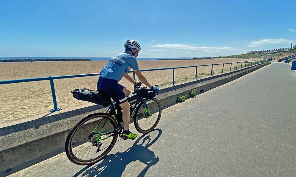
Perhaps not surprisingly, the least fun part of the route were the urban sections around the two industrial towns. Our route was still on bike paths, but it felt very disjointed and awkward in places. Luckily, once we had successfully navigated around them we were back to more scenic riding and equally importantly, back on gravel trails again. What was interesting was that the highest proportion of gravel riding that we did was the last section coming back into Newcastle. Of the last 30kms of our ride, I reckon 70% was off-road on gravel trails. They were urban gravel rather than through some pristine rural landscape, but gravel riding is always good, no matter where it is, right?
Our bike computers clicked over 200kms just before we got home. Not epic or record breaking, but as we sat in the sunshine and enjoyed a post-ride beer, it felt like we had been away for way longer than just 2 days. A point-to-point gravel journey, even one where the level of comfort was set to holiday rather than slog, felt like a proper adventure. I’m already planning our next one.
The route I’ve uploaded here is a slightly more gravelly version of the one we actually rode. It takes in a couple of sections of trail that we skipped on our trip, but which I would add in if I ever repeated it.