Most gravel riders will have a set of local trails they consider their own. These trails will have a well-worn mental groove running down the middle of them and you will probably ride them in a set direction and linked together to give the ride a particular flow or feel. But once in a while it’s worth jiggling things up. Try riding your favourite trail in the opposite direction. Or connect the dots in a different way. You might find that the challenge will breathe some life back into your old-but-getting-a-little-boring-now-if-we’re-honest favourites. This was my first thought when I saw the proposed route for the recent Alpkit Sonder Winter Gravel Series.
Despite a slightly gloomy weather forecast, we were treated to miraculous levels of sunshine and blue skies for most of the day.
The series is designed to showcase the local gravel riding around nine of their UK stores, with rides planned everywhere from the leafy London suburbs of Kingston-upon-Thames to the gritstone outcrop dotted moorlands near to their Hathersage store. Gravel Union’s UK headquarters is located less than 20 minutes ride away from the Alpkit Gateshead store, so we figured it would be rude not to sign up and join in the fun.
“You might ask why the heck anyone would choose to pay to ride their local trails, which is a fair question.“
Alpkit have been running the Sonder winter gravel ride series for the past couple of years and each one has a similar ethos – they’re self-led, non-competitive routes, designed partly to showcase the local riding and partly to help persuade gravel riding fans not to hibernate on the sofa once the days get shorter and the trails get wetter, but to get out there and make the most of their local riding. You might ask why the heck anyone would choose to pay to ride their local trails, which is a fair question.
The easy answer to that is that the rides are incredibly good value anyway (only £10 a head), but also the proceeds of the event are donated to the Alpkit Foundation – their charity which promotes grass-roots outdoor projects. As well as providing a GPX file (and free komoot map pack for the local area), the Alpkit staff had laid on free hot drinks before the start and soup, teas&coffees, snacks and most importantly, donuts, for riders when they were safely back at the end of the ride.
Luckily the queue for the post-ride donuts wasn’t too hideous.
“I pored through the details, trying to figure out which trails Alpkit’s route finding guru had selected for the event”
Like all good map fans, as soon as the link to the proposed route came through, I pored through the details, trying to figure out which trails Alpkit’s route finding guru Paul Ridley had selected for the event. In my never ending search for newness I was interested to see whether Paul had included anything that I didn’t know. The saying that “every day is a school day” was clearly applicable, as despite having ridden for nearly a decade in the north-east, there was a section of trail that I didn’t know within the first 10km of leaving the Gateshead start point and more later in the ride too.
“The participants were a brilliantly eclectic bunch, with a huge variety of types of bikes and rider”
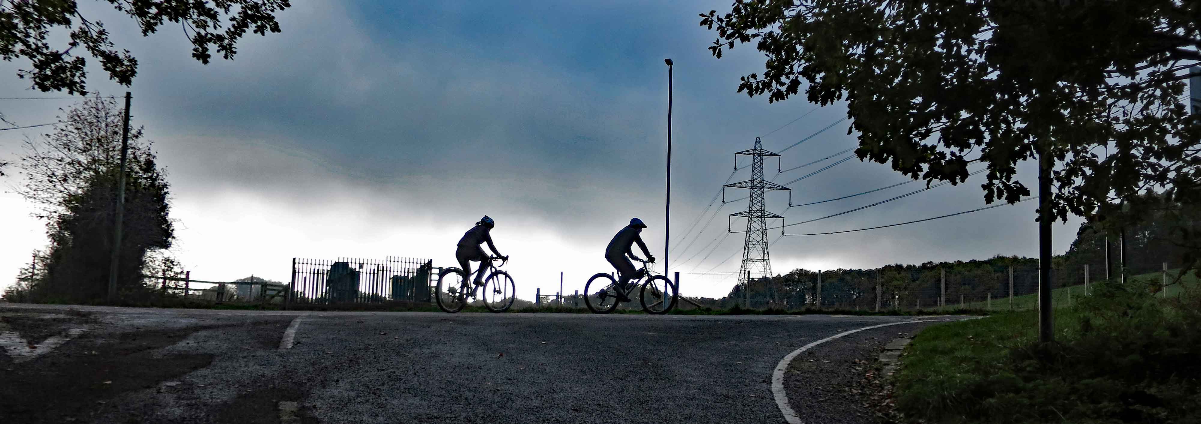
After a short safety briefing, the assembled peloton set off. Within a few minutes, a group towards the front took a wrong turn and merrily headed off to ride the route in the wrong direction. Fortunately, they soon realised their error and made up the time on the opening road section, so that there was quite a large group on the first off-road climb. As the air temperature rose and everyone started to warm up, there was plenty of friendly chat. The participants were a brilliantly eclectic bunch, with a huge variety of types of bikes and rider. Even the clothing choices were interesting – everything from baggy shorts and a lightweight jacket combo to full-on winter kit. Flat pedals. A carbon fat bike. Flat bars and drop bars. Hybrids, 20-year-old MTB with 26” wheels, ‘cross bikes, monstercross bikes and top of range carbon gravel bikes. Full mudguards. No mudguards. If you could imagine it, you could probably find it within the group.
"It’s easy to assume you know where the route will go when gravelling from point A to point B"
The problem with knowing your local trail network super well, but then following someone else’s GPX route file is that it’s easy to assume you know where the route will go when gravelling from point A to point B. Despite having a fully functioning bike computer on my handlebars, on a small number of occasions during the ride my brain decided we should be taking a particular trail from the half-remembered mental map that I was carting around with me, rather than the actual route that Paul had planned. The first time I did it I felt super guilty, as a small group of riders following on behind assumed that I knew where I was going and followed me down an erroneous trail. Luckily, karma came and paid me a visit a few times later on, when I followed other riders who were doing exactly the same thing – assuming they knew where they were going rather than following the exact GPX route.
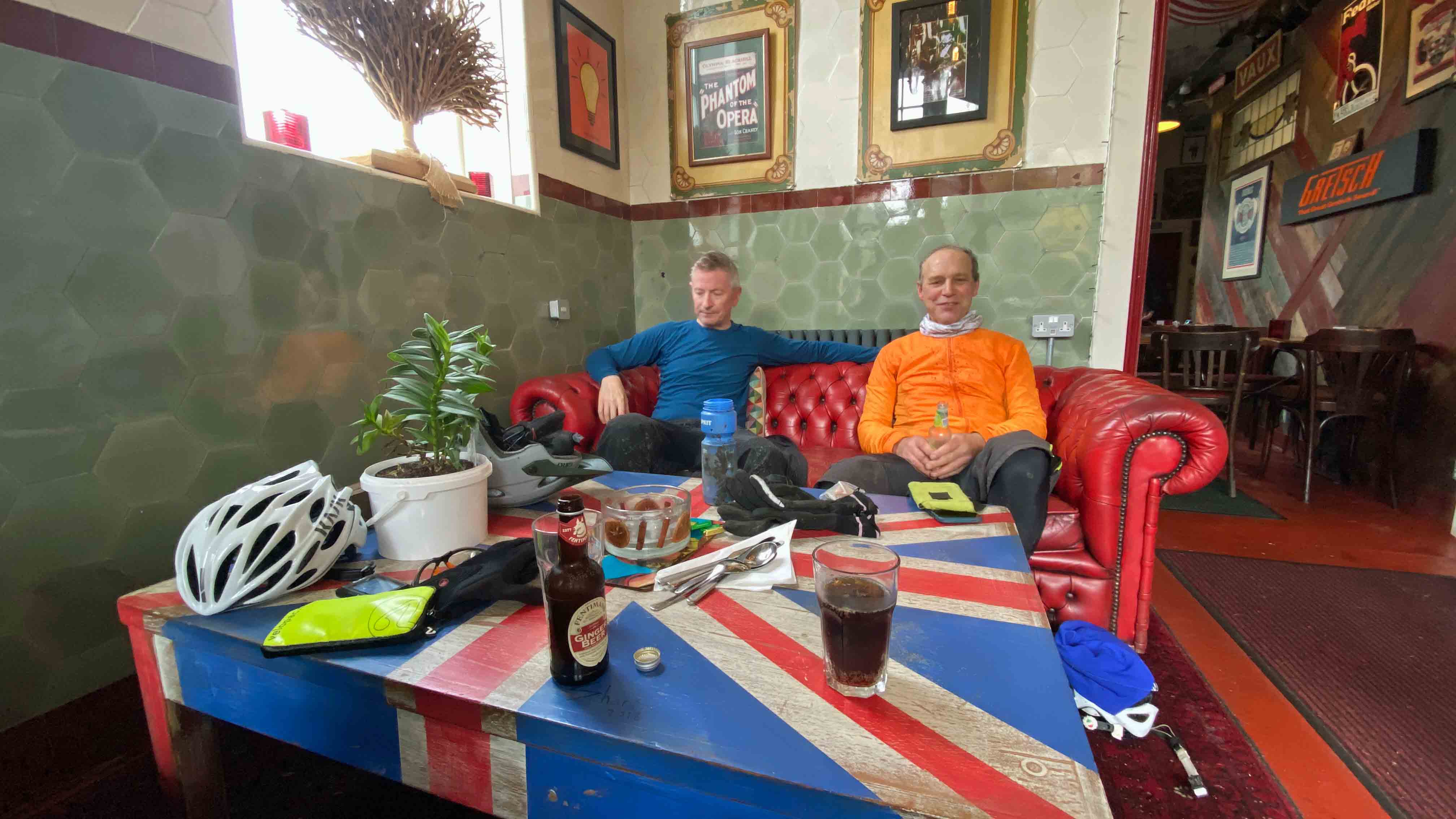
"At lunchtime we found ourselves in a local café, ensconced on a leather sofa, listening to classic 1960s tunes and practically inhaling bowls of soup"
The flip side of having local knowledge of course is that it can also be used to your advantage. As the event was non-timed, non-marshalled, self-supported in style, it meant that taking a slight deviation from the prescribed route wasn’t going to be considered cheating or cause any issues for the event staff. So this is how at lunchtime we found ourselves in a local café, ensconced on a leather sofa, listening to classic 1960s tunes and practically inhaling bowls of soup. If you just had your head down and were precisely following the GPX track, you maybe wouldn’t spot the little nuggets of rooty singletrack running parallel to the proper route and which allowed for more adventurous riders to spice up the route slightly, or more importantly, you’d ride straight past the door of a great café and miss out on the mid-ride chance to refuel.
"The mix of trail surfaces was impressive too and really showcased what north-east England has to offer"
Despite (or perhaps because of) the route not being super-long, Paul had added in plenty of elevation changes to keep the riding interesting. Depending on your fitness and skill level, not to mention your tyre choice and love of finding grip on mud-slicked tree roots, everything was rideable and the challenge level for my little group at least was perfect. The mix of trail surfaces was impressive too and really showcased what north-east England has to offer – ancient railways converted into bikepaths, forest roads, narrow singletrack, fast stony descents, clarty bridleways, small sections of road and an occasional snicket – there really was something for everyone.
When you’re riding with a group that includes your wife, the balance between giving advice/guidance on what’s coming up next or deciding to keep quite so that they don’t feel pressured or judged is a difficult one. I knew that one particular section of trail (Milkwellburn, we’re looking at you) would be the ‘crux’ of the route. It runs along the edge of the former Hollins Hill quarry and apart from a short window when it dries out in the summer, it’s generally about 10cm deep in wet clay. The trail is hemmed in by a barbed-wire fence on one side and a hillside covered in stinging nettles on the other, so you have very little room for manoeuvre.
The good thing with this trail is that it’s short – around 300m from start to finish. It’s also flat – good because at least you’re not fighting gravity, but bad because it doesn’t drain. It’s a real mind-game of a trail. A lot of riders give up as soon as they see it and decide it’s not rideable, but if you persevere it’s possible to ride cleanly through it. I knew all this, because by either total fluke or good planning, I’d ridden the same trail a few days earlier. This meant I could give some pretty accurate advice on what was coming up next and some tips for riding it successfully.
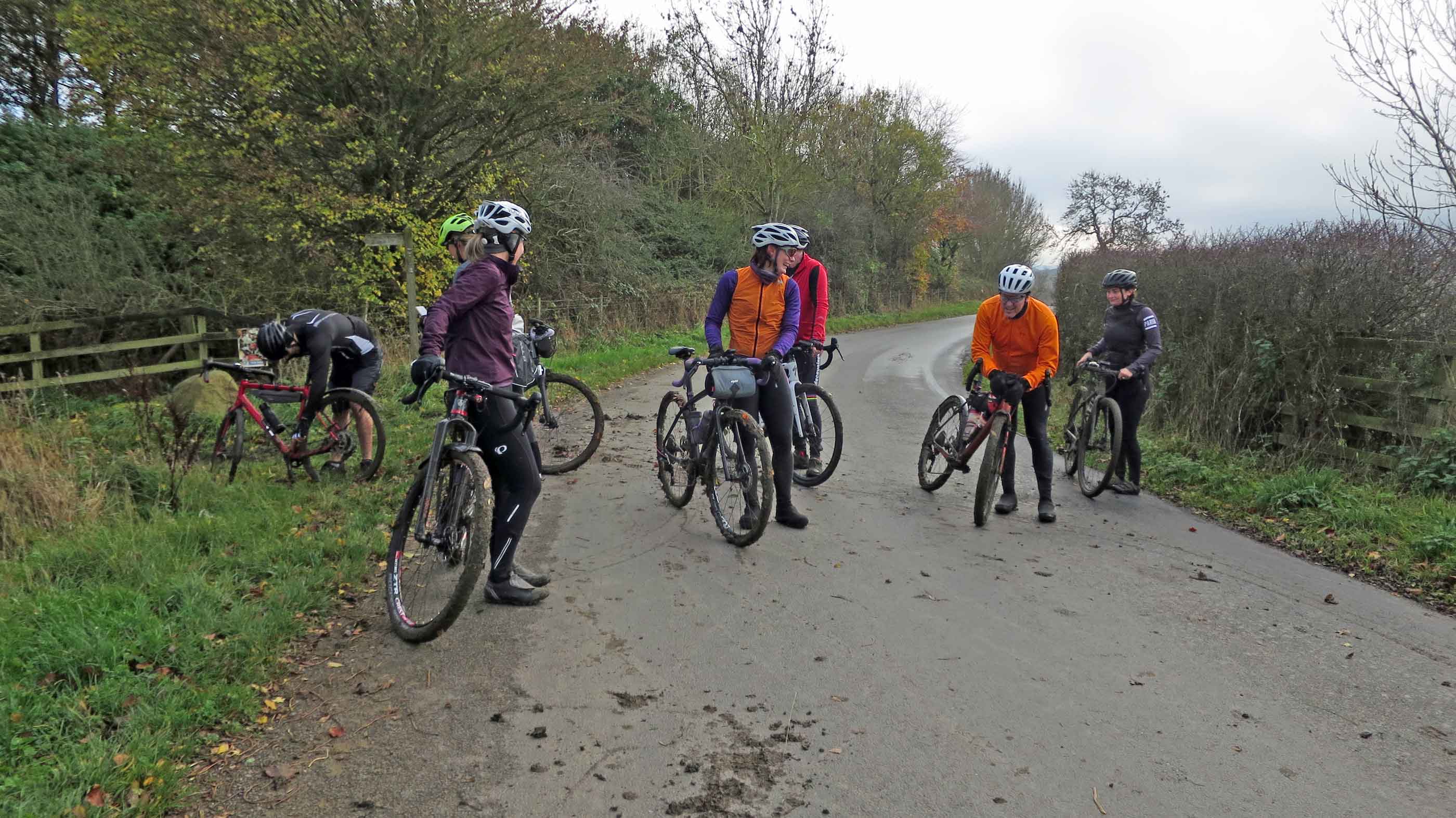
"The trick is simple - channel your inner cyclocross rider, grit your teeth and keep pedalling"
The trick is simple - channel your inner cyclocross rider, grit your teeth and keep pedalling. For such a short section of trail, it’s ridiculously hard work and the stickiness of the clay means there was a lot of de-clagging bikes once we reached the road at the end, but the big grins demonstrate the satisfaction of overcoming the slop (or the relief of reaching the end…).
We knew that after the mudfest, all we had to do was endure the climb up to the glider station and from there it was plain sailing back to the Alpkit store. The descent from the glider station ridge was unique in the route in that it’s super-fast with great sight lines but gets progressively rockier/gnarlier the further down you go. It’s the absolute tailor-made destination for a snakebite puncture, particularly if you’ve previously ridden it on an MTB but were now tackling it on a gravel bike. Luckily, we got the bottom unscathed and then soaked up the golden late afternoon light on the climb up to Greenside.
The final descent, which totalled 6kms, took in some of Gateshead’s incredible industrial heritage with a trip down Blaydon Burn. With almost 400 years of industrial usage, the valley is still littered with remnants, although as the trail is super-fast and flowy, it’s easy to just focus on the ride and not take in any of the history around you. Brought to an eventual screeching holt by one of the anti-motorbike barriers (never a barrier to a determined Clive, of course), before arriving back at the River Tyne, the final section of our route was a gentle spin on a bike path all the way back to the finish line.
“We’ve definitely burnt off enough calories to justify a jam donut, haven’t we?”
A warm welcome from route designer Paul and the other Alpkit staff, combined with a table laden with cauldrons of hot soup, hunks of baguette and as much tea/coffee as you could handle, it was the ideal end to the ride. “We’ve definitely burnt off enough calories to justify a jam donut, haven’t we?” was the rhetorical question I posed to my wife. Everyone knows the gravel world is powered by soup and donuts after all….
Thanks, Alpkit for a great day out. We loved every minute and the post-ride donuts were the icing on the gravelly cake.